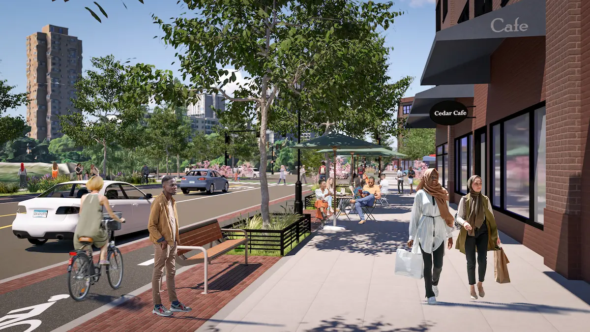
Transforming the existing I-94 freeway to a boulevard and allowing restoration of urban land use in this location has the potential to unlock dramatic opportunities for housing, economic opportunity, and neighborhood amenities, including parks.
Decisions about major public infrastructure such as I-94 are, by definition, long-term in nature. As cited in the highway history described in Chapter 2, the decision to construct I-94 through established, fully developed urban areas set a precedent for the land use of the area for two generations. With the boulevard conversion option, decision-makers have a viable pathway to make the project area into a more productive, more accessible and healthier element in the Twin Cities landscape.

Currently, I-94 commits 366 acres of centrally located urban land to exclusive freeway use between Minnesota State Capitol and the 35W interchange. Expressed differently, this represents the footprint of 50 Allianz Field stadiums, three Ford plant sites (now Highland Bridge), or 18 Upper Harbor Terminal areas.
Conversion to a boulevard will reduce the land area consumed by transportation infrastructure and allow for more land uses that generate community and economic benefits in previously underutilized freeway right-of-way. A boulevard format provides for a continued transportation role for the corridor while adding housing, space for commercial activity, links to parks, fewer barriers to local trips, and reduced health costs associated with the toxic freeway use.
The neighborhoods through which I-94 currently runs were originally developed with continuous street grids serving the range of land uses such as housing (single-family, multifamily and other) and commercial (primarily one, two or three-story structures). Those areas were cleared of property and streets and replaced with the lanes and surrounding right of way of I-94 sixty years ago. Still, the scale of local neighborhood land use and development found along streets in other Twin Cities neighborhoods provide insights into how the space could alternatively be used.
As outlined in the Reimagining I-94 report, Visible City measured and applied land use mixes to the project corridor and projected economic and community impacts for a boulevard conversion. The consultant team calculated and applied how the 366 acres that comprise the I-94 corridor between 35W and the Minnesota Capitol could be reprogrammed to provide multimodal transportation infrastructure and also meet community needs through housing units, employment, and additional tax base.
In aggregate, the 86-96 acres released from transportation use in the I-94 study area could support community development at the following scale:
| ELEMENT | LOWER DENSITY | MODERATE DENSITY | MEDIUM DENSITY | MEDIUM DENSITY |
| Job Estimate | 230-255 | 870-965 | 1,660-1,880 | 2,200-2,450 |
| Market Value Estimate | $202.1-223.3M | $153.3-169.8M | $267.1-295.8M | $425.5-470M |
| Housing Units | 510-565 | 890-990 | 1,665-1,885 | 2,020-2,230 |
Each of these density levels reflect development patterns observed on and around commercial streets in Minneapolis and in Saint Paul. Given the central location of the I-94 corridor, the consultant team believes that land released from exclusively freeway use in a boulevard conversion, could develop at any of the evaluated density levels including higher density. A process in each city will provide for rezoning and other regulatory controls to maximize community benefit, allow for location of spaces for commercial, civic and residential use, and support transition from exclusive use as freeway.
Community Benchmarks
As part of this transition, where centrally located and valuable land would become available for uses to meet community needs, a community land trust model is recommended as part of the land ownership mix. Check out all of our community benchmarks to prevent displacement.
Join us in contacting decision-makers.
Take action by emailing key decision makers and standing up for reparative justice.