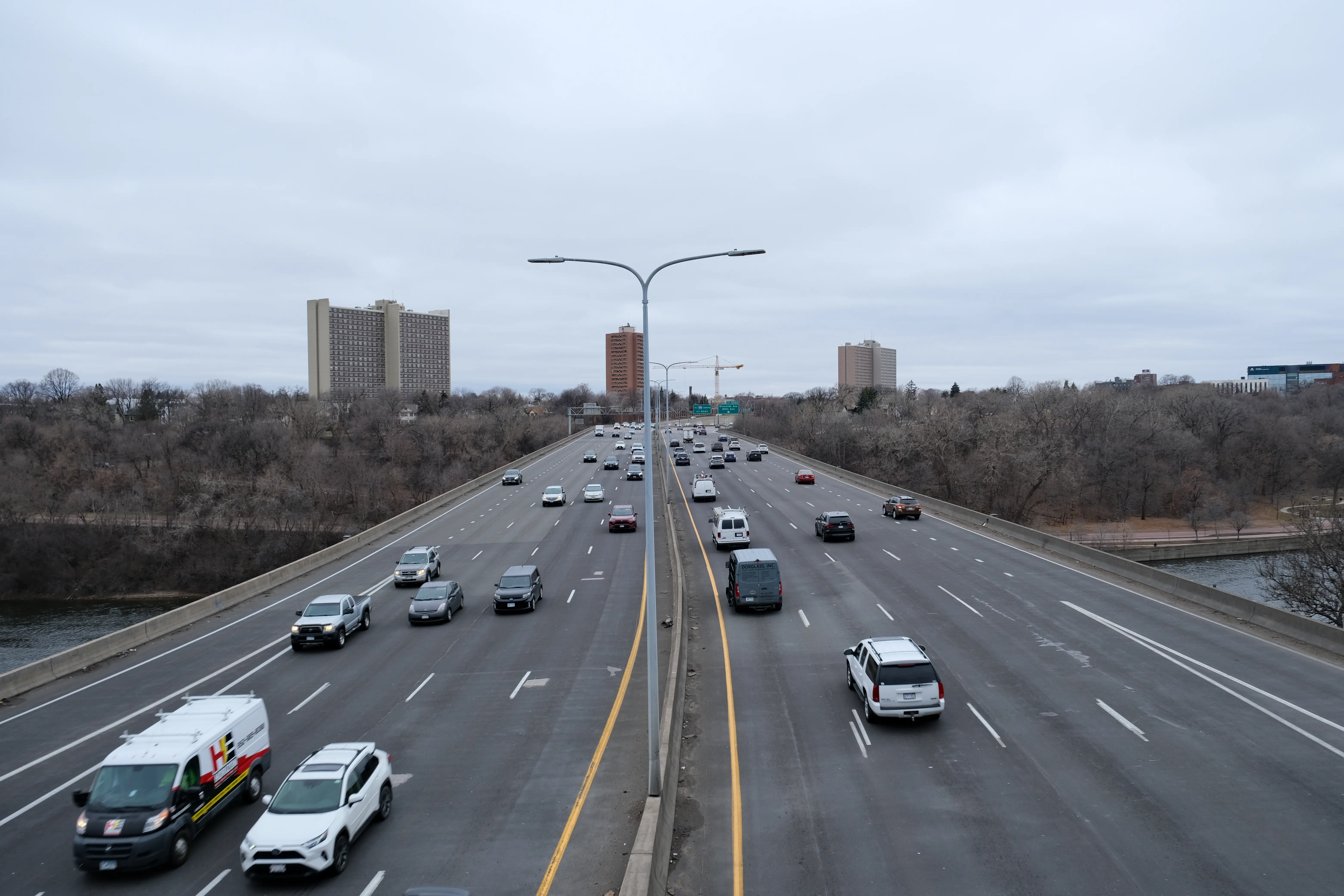
We need to understand current travel patterns to understand how the Twin Cities Boulevard can meet Minneapolis and Saint Paul’s needs for access and mobility.
Using data available from MnDOT, Replica (a platform for built environment data), and data included in MnDOT’s Rethinking I-94 Phase 1 report, we can gain insights into current multimodal travel behavior and volumes.
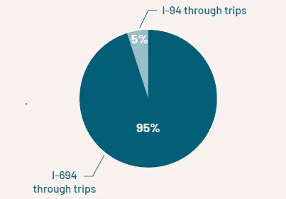
Through Trips Avoid Using This Section of I-94
“Through traffic” means motorists passing through the Twin Cities with no local destination or origin. In other words, people who are neither starting nor ending their trips in the project area but are merely passing through it.
Today, only a small portion of through traffic uses I-94 in the project area. Regional through traffic is served primarily by I-694 and the Twin Cities outer loop highway network.
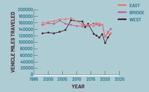
Since the Pandemic…
Looking at historic traffic trends on MnDOT’s website, traffic volumes on I-94 in the study area peaked between 2004 and 2008. Volumes declined significantly during the pandemic. Overall, VMT is back to 2019 levels, but travel patterns and behavior are different, with more non-work trips made throughout the day.
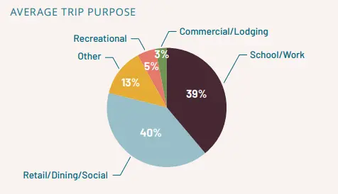
Most Trips on I-94 Are Local
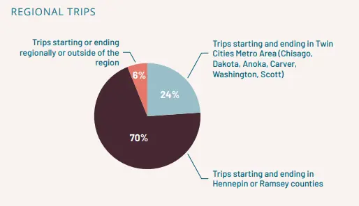
I-94 serves significant daily traffic compared to other highways in the region, but most of these trips use I-94 within the project limits for short distances. The most common trips and most visited destinations accessed from the project corridor are almost exclusively within the Twin Cities. Most trips start and end within Minneapolis or Saint Paul.
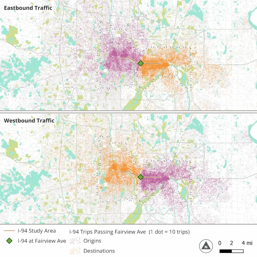
A Majority of Trips Begin and End Within a Mile of the Study Area
The maps below show the origins (purple) and destinations (orange) of trips passing through the center of the study area near Snelling Avenue. The great majority of I-94 users start and end their trip within a mile of the study area or near downtown Minneapolis or Saint Paul. These motorists rely on the highway for only a portion of their trip.
A well-connected network of multimodal urban streets can serve these local trips far more efficiently and with far less harm than an interstate highway. The most common average trip duration along I-94 is 5 minutes, compared to 15 minutes and 20 minutes for I-494 and I-694, respectively.
The high percentage of local trips using an interstate highway creates bottleneck, congestion, and network issues. Local trips to daily destinations and activities are ideally served by the local street network, which provides direct connections to different areas, disperses traffic, and facilitates efficient local travel.
Most Trips Use the Highway for a Short Distance
Among all trips using I-94 in the project area from either direction, only 33% of vehicles travel through to the other end of the study area. According to data from Replica, the average trip uses this portion of I-94 for about 4 miles.
I-94 is a Barrier
The I-94 trench interrupts the street grid and limits local access, dividing Minneapolis and Saint Paul into north and south. This causes congestion and safety issues where north-south travelers are restricted to specific roadways and bottlenecks at limited entry/exits to I-94 and at complicated highway interchanges.
The barrier is felt most acutely by people walking or biking, as there are relatively few crossing opportunities, many of which also have interchanges. Getting across I-94 is unsafe and uncomfortable for people walking, using wheelchairs or strollers and riding bicycles.
Join us in contacting decision-makers.
Take action by emailing key decision makers and standing up for reparative justice.