Minneapolis City Council Members Robin Wonsley and Jeremiah Ellison are proposing a resolution to address the historic and ongoing harms of Olson Memorial Highway, a notoriously unsafe highway that destroyed a redlined Black and Jewish community when constructed. The City Council will vote on the resolution Thursday, May 11, 2023.
Latest Update
Minneapolis City Council passed the resolution unanimously! Thank you to all supporters for contacting your City Council Members to express your support.
Every year, people are killed and seriously injured in crashes on Olson Memorial Highway. The City of Minneapolis Vision Zero Initiative first identified Olson Memorial Highway as a crash concentration corridor and high-injury street in 2017. The resolution calls on the Minnesota Department of Transportation (MnDOT) to implement initial safety measures that are cost-effective and proven to reduce crash rates.
“These safety improvements are long overdue. In 2019, the city’s Vision Zero plan promised change, but despite requests from the community and Harrison Neighborhood Association, there’s been no meaningful action on the part of the city to protect our residents from death and serious life-changing injuries,” says Nichole Buehler, executive director of the Harrison Neighborhood Association. “We’re hopeful that the city will adopt this resolution to show their commitment to the health and safety of our residents.”
Longer term, the resolution outlines the city’s support for removing the highway and restoring a walkable neighborhood commercial street with community-guided development. These highway conversions are part of a larger national trend for urban highways like Highway 55, which sees less traffic than West Broadway Avenue, a street varying from 3 to 4 lanes and a speed limit of 30 mph.
“Highway removal is a form of racial and environmental justice,” says Council Member Wonsley. “The placement of Olson [Memorial] Highway was a deliberate decision, and it triggered several decades of continued disinvestment.”

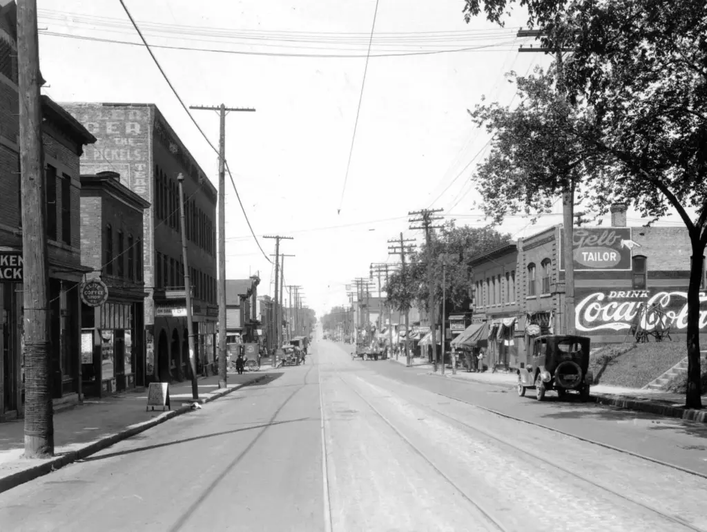
Looking west down 6th Avenue towards the Lyndale Avenue intersection, June 28, 1922. The Kistler building is on the left. Courtesy Hennepin County Librarie
Wonsley refers to racial covenants, a tool used to segregate communities that received little investment and permitted industrial uses that exposed residents to environmental hazards. In the 1920s and 1930s, the Near North neighborhood along “Old 6th Avenue North” was one of the few areas in Minneapolis where families targeted by racial covenants could live. In 1938, the Minnesota Highway Department, known today as the Minnesota Department of Transportation, evicted hundreds of people in the Near North neighborhood from their homes and businesses to make way for Highway 55.
Part of the resolution seeks to address climate and environmental justice concerns. In the face of the climate crisis, transportation is the biggest contributor to greenhouse gas emissions. In addition, highways contribute to pollution and health disparities in surrounding communities. North Minneapolis has the highest asthma hospitalization rate in the Twin Cities metropolitan area.
This resolution would inform important decisions about the future of Olson Memorial Highway. MnDOT is currently studying the long-term future of the corridor, with a construction project planned for 2028. The Minneapolis portion of the highway is scheduled to receive safety improvements later this year.
“We now have a once-in-a-generation opportunity to choose not to double down on past decisions,” says North Minneapolis resident and executive director of transportation advocacy nonprofit Our Streets Minneapolis, José Antonio Zayas Cabán. “Instead, we can invest in infrastructure that repairs historic injustice and prioritizes the health and well-being of the surrounding community.”
Some of these concerns were to be addressed with the construction of the Blue Line Light Rail Extension on Olson Memorial Highway. The light rail project was set to bring modest but much-needed traffic safety improvements and high-quality public transit service. However, after years of planning and development, the Metropolitan Council re-routed the Blue Line Extension, and planned safety and transit improvements disappeared, leaving only increased rent.